Cape Cod Canal
The Cape Cod Canal connects Cape Cod Bay with Buzzard's Bay to the south. The Cape Cod Canal is a great place to fish for striped bass.
Cape Cod Canal Striped Bass Fishing
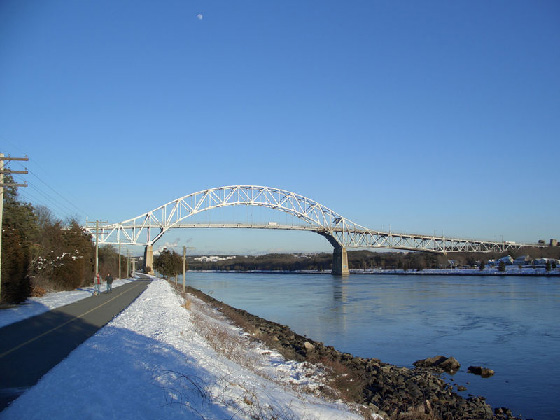
The Cape Cod Canal is a man-made waterway traversing the narrow neck of land that anchors Cape Cod to mainland Massachusetts. It is part of the Atlantic Intercoastal waterway.
Many striped bass on their migration north in the spring, and on their return south in the fall, take a short cut through the canal rather than swimming all around the cape. This makes the canal one of the best places to fish for striped bass.

Pete Beard and his Striper
Photo from Surfland B&T
Link to Larger Image
No boat fishing is allowed in the canal. However many fishermen fish for striped bass from its' banks. The service road along its' edge is closed to car traffic. Many fishermen use bicycles outfitted like "bike-buggies" to move from spot to spot along the canal, and to transport their catch home.
It is interesting that most fishermen fish the slack, or near slack periods of the tides in the Canal. This is because the current is so very strong during the mid tide stages.
Popular lures for fishing the canal are lead headed bucktails and metals with hair on their hooks. Swim shads are also effective, but you must use some weight ahead of them to get them down deep. Most use fairly heavy lures, 4 ounces or more, that can be gotten down deep in the canals currents.
Cape Cod Canal - US Corp of Engineers
See Larger Maps Below
About the Canal
The Canal is roughly 17.4 miles long and connects Cape Cod Bay in the north to Buzzards Bay in the south. The 540-foot width of the canal is spanned by the Cape Cod Canal Railroad Bridge and two highway bridges; the Bourne and the Sagamore. Traffic lights govern the approach of vessels over 65 feet and are located at either end of the canal.
On June 22, 1990, construction began for a working canal under direction of August Belmont, Jr's "Boston Cape Cod and New York Canal Company", to designs by engineer William Barclay Parsons. The canal opened on a limited basis in 1914 and was completed in 1916. This privately-owned toll canal had a maximum width of 100 feet and a minimum depth of 25 feet. It took a somewhat difficult route from Phinney Harbor at the top of Buzzards Bay. Due to the narrow channel and navigation difficulty, several accidents occurred which limited traffic and blackened the reputation of the Canal. As a result, toll revenues failed to meet investors' expectations.
During Word War I, German U-boats attacked ships traveling along the far Atlantic coast of Cape Cod, making the Canal an important "safe" shipping lane. In 1928 the government purchased the Canal for operation by the United States Army Corps of Engineers as a free public waterway. From 1935 to 1940 the Government rebuilt the canal, increasing its approach width to 540 feet and its depth to 32 feet. It became the widest canal in the world. The southern entrance to the canal was rebuilt to proceed directly from Buzzards Bay rather than through Phinney Harbor.
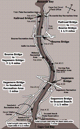
Cape Cod Canal Maps
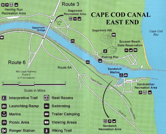
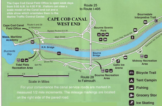
Cape Cod Canal Maps, East End and West End. The East End and West End of Cape Cod Canal Maps were created from U.S. Army Corps of Engineers pamphlet "Cape Cod Canal Recreation Guide" NAEEP-360-1-18, June 2000.
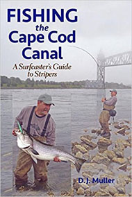
Book